Sunday, May 24, 2015

Shafer Trail

Rating: 2
This trail has a few ruts and rough spots that would make it difficult in a passenger car. However, if you take care you could likely do it in a typical passenger car.

Location
This is located in Canyonlands, near the Island in the Sky Visitor Centor.

Trailhead
This starts 0.2 miles after the fee booth when you enter the Island in the Sky District of Canyonlands. It is on your left as you enter the park. GPS coordinates are 38°28'17.4"N 109°48'41.3"W (38.471514, -109.811468).

This road connects to the Potash Road and the White Rim Trail. Shortly after you reach the bottom of the switchbacks, the Potash Road is a left turn. If you go straight you will be on the White Rim Trail. Unless you are ready for a LONG day or a 2-3 day trip, make sure you stay to the left and go on the Potash Road. The White Rim Trail is about 100 miles of slow dirt road. Most people do the White Rim Trail in 2 days. The turn-off to the Potash Road is well marked. Coordinates are 38°27'33.6"N 109°47'40.9"W (38.459335, -109.794693).

The Potash Road is a dirt road until after you pass the Potash Plant. The road then follows the Colorado River and comes out just northwest of Moab and joins Highway 191. If you want to go up the switchbacks, you can start from this end and turn down the Potash Road from Highway 191. It is well marked. Coordinates of the turn off are 38°36'22.1"N 109°36'07.7"W (38.606141, -109.602149).

Description
This is a fun, easy road that is fairly well maintained. This gives you great views of the scenery of Canyonlands and is an alternate way to get into the Island in the Sky District. The famous portion of this road is the switchbacks. They are not difficult, but it is steep and rides along a cliff edge which could be scary for somebody not used to this type of driving. The road is plenty wide and there is usually enough space to pass another vehicle. There are also multiple pullouts making it even easier to pass oncoming traffic.

Remember, etiquette is that uphill has the right of way.

At the bottom of the switchbacks there is a well marked left turn that takes you to the potash road and back to Moab. If you continue straight you will start the White Rim Trail. The White Rim Trail is a spectacular trail that follows a rim of white rock (hence the name) and offers many spectacular views. We had a few hours to spare so we followed this trail and went down Lathrop Canyon, a total of about 15 miles. I can't wait to come back and finish the White Rim Trail!

Here are the GPX and KML files from our trip. This is the entire trip through Shafer Trail, along part of the White Rim, and down Lathrop Canyon, then out the Potash Road. I appoligize that the route goes into Moab, I forgot to turn off my GPS and I was too lazy today to edit that portion out.


 This picture was taken from the viewpoint by the Visitor's Center.

 These are the Shafer Switchbacks.


 This is the Potash Plant.


Fins and Things

Rating: 4-5
Depending on the route and direction you take, the rating will range from a 4 to a 5. The direction we took required a tow strap on one hill for a mildly modified Grand Cherokee giving this a rating of 5. If we would have gone in the other direction, it would have dropped the rating to a 4. 

Location
This is East of Moab on the Sand Flats Road. 

Trailhead
This road is in two parts. The first part is to the south of Sand Flats Road and the second part is to the north of Sand Flat Road.

The first part of Fins and Things starts 1.9 miles down the Sand Flat Road from the toll booth, coordinates are 38°34'48.5"N 109°29'58.0"W (38.580127, -109.499438). It is to the right. You go through a small campground (I believe it is campground E). The trail starts next to camp site E-6 according to the Sand Flats Recreation Area website. This portion of the trail comes out on Sand Flat Road 2.8 miles measured from the toll booth, coordinates are  38°34'58.7"N 109°29'06.3"W (38.582961, -109.485089).

The second portion is quite a bit longer. If you do the first portion, turn right (East) onto Sand Flats Road and the turn-off is to the left in 1.1 miles.  Measured from the toll booth it is 3.9 miles. Coordinates are 38°34'36.4"N 109°28'06.5"W (38.576778, -109.468487). This portion of the trail travels back toward the toll booth. 

The exit of the second portion is 1.5 miles from the toll booth and is on your left. Coordinates are 38°34'56.9"N 109°30'26.0"W (38.582480, -109.507215).

We had only a few hours so we didn't do the whole trail. We only did the second portion, and we ended up going in reverse. I can't speak for the first portion, but the second portion is a little easier if you go in the normal direction (starting 3.9 miles from the toll booth). 

Description
This, along with Hell's Revenge, is what Jeeping in Moab is all about. There are ledges, slick rock climbs, sand, and great scenery. This can be done in a stock vehicle (such as a Jeep Wrangler) if you have good approach and departure angles. Do not take a stock cross-over SUV as it won't have good approach and departure angles. If you do it in a stock vehicle you will need to take some care to avoid hitting your bumper. We did this years ago with my cousin in their Land Rover (I believe it was a discovery, but I don't remember). Their vehicle did really well, but their bumper didn't.

This is a popular trail and expect a lot of traffic. This is especially popular with UHVs (side-by-side). If you aren't in a UHV, be ready to let them pass you as they can travel much faster than I can in my Jeep. 

For the most part this trail isn't very technical. There are a lot of steep climbs and descents over slick rock fins. There are also a lot of rock ledges. Most of these are not difficult for a stock vehicle, and many of the ledges have different routes that makes it passable by most vehicles.

There is one obstacle that was difficult for our vehicles. We had a 2000 Cherokee with 31" tires and 3" lift and a 2000 Grand Cherokee with 31" tires and 2" lift. Both had open differentials. Going backwards we had to go up the most technical portion. It looked deceivingly easy. There were two routes, one up a ledge that was pushing the limit of my clearance in the Cherokee. The other option was a rock slope that looked easy but turned out to be a "Jeep Trap" for the Grand Cherokee. We had to strap the Grand Cherokee up the hill. Like I said, if you don't do the trail in reverse, you will go down this obstacle making it much easier.

This obstacle did teach me a valuable lesson: take my strap out of the Jeep on level ground. I backed up into position to strap my brother up the obstacle and I opened my tailgate. Obviously, I wasn't thinking ahead. I easily retrieved the strap from the back of the Jeep. Without any further effort, I was rewarded with a 12 pack of soda pop, my cooler, my camp chairs, many snacks, sunscreen, and other odds and ends all falling out of the Jeep. One can of pop exploded when it hit the ground (luckily it was a Diet Coke, my wife felt it was unlucky). It took 3 of us to hold the cooler in and shut the gate. It took about 5 minutes to get everything back into my Jeep. Not my brightest moment...

Here are the GPX and KML files of my track.

If you want the other portion of the trail that we didn't do, here is a KMZ that I made with google maps. It includes the KML from above and then I traced the route in google maps to make the portion we didn't do. 

 Oh how I love slickrock!


 I love this picture of Tranvis's Jeep!

 This is a spur that take you to an overlook half way through the trail. It is well marked if you want to go.

 Travis enjoying the scenery. 

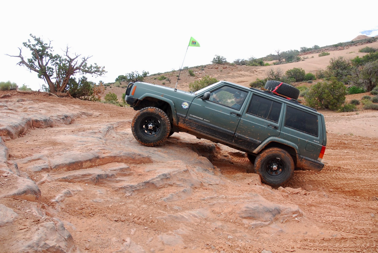
This is the obstacle that gives the trail a 5 rating if you go in reverse. It was the max that my vehicle could do. I actually was sitting on my transfer case (maybe it's time to get a skid plate?) The "bypass" is just as hard for a vehicle this size because of the off-camber line you are forced to take.


 This is the bypass to the above obstacle. It doesn't look hard, but if you don't have good flex in your suspension you will struggle with this spot. You are forced to take an odd angle due to rocks on the side of the trail. There is also a rock/ledge just in front of the Jeep you can't see that forces you to turn left. This forced left turn makes it more difficult. 


 Overexposed picture, but nice flex!


 Here was my smart move of trying to open the tailgate on a hill to get out the tow strap. We tried to get the gate closed with two people, but it didn't work.

 Then things started falling out of the back. 

 We didn't get more pictures because the beautiful photographer (my wife) decided it was time to come help. It took three of us to get it shut, and that is after more junk fell out of the back.


Thursday, May 7, 2015

North Rim of the Black Canyon of the Gunnision

Rating: 1
The last 6 miles are dirt roads. This road is very well maintained, especially once in the National Park. This can be done in a passenger car easily. We did it in the rain and the roads weren't slick or difficult.

Location
This is located at the Black Canyon of the Gunnision National Park.

Trailhead
The turn-off is located on Highway 92, 3.2 miles south of Crawford, CO. The turn-off will be to your right (West). It is immediately after the Crawford State Park.

GPS coordinates of the turn-off are 38°39'49.8"N 107°35'40.0"W (38.663820, -107.594450)

Description
This is the route you take to access the north rim of the Black Canyon National Park. This is a small national park, but it is spectacular. The north rim is closed during the winter months. The north rim offers some spectacular views and is more "intimate" than the south rim. The traffic is less on this side. There is no bridge across the canyon, so if you want to see both sides you need to plan on a 2 hour trip to go from the South Rim to the North Rim. The only access to the bottom of the canyon is either by hiking or a road on the South Rim. The road to the bottom is a paved, steep road (16% grade) that is worth the trip.

Black Canyon is narrow, deep canyon. There are many views of the high cliffs. Often the view areas take you right to the edge of a cliff. There are often railings that allow you to hang over and look down at the river 1,800 ft below. The highest cliff in Colorado is located in this canyon, and is 2,250 ft high.

There are many hikes in the area, and most of them are short. Many of the view points are just off the road or are only a few minute walk to the edge. If you want longer hikes, they are available as well.

Here are the GPX and KML files for the trip.

It was a rany, cloudy day. The clouds made for some neat views!

The cliff to the right of the picture is Painted Wall, the tallest cliff in Colorado at 2250 ft!