Wednesday, August 13, 2014

Ecalante Rim

EDIT: I took our non-trail rated Jeep Patriot on this trail starting from Escalante Canyon and going uphill. It does not have low range. It did really well, and many crossover SUVs will be able to do this trail without difficulty. The main area of concern is the stream crossings. If the water is high, a small vehicle may not have a high enough clearance to safely cross the stream.

Difficulty Rating: 2.5. The reason for the 2.5 rating is if you start from Escalante Canyon and go up the road, low-range is not necessarily needed but would be nice. I would not want to take my Jeep Patriot up the road because it wouldn't  have the power to go over some of the rocks due to the steep hill without the low range. If you start from Delta and go down, a cross-over SUV should have no issues as long as you take care to go around the higher rocks. If you start from the Delta side, then it would be rated a 2.

Location: The trail starts near the beginning of Escalante Canyon and comes out at Delta, CO.

Trailhead: 11.9 miles north of Delta, CO from the Maverick gas station downtown. The GPS coordinates are: 38.784704, -108.246905. This is the trailhead for Escalante Canyon, and there are signs marking the turn. Take the Escalante Canyon road 6.2 miles, and there will be a turn to your left for the Dry Mesa Road and Escalante Rim Road. 0.6 miles after this turn there will be another turn to your left which is the Escalante Rim Road which is actually where the trail starts. Coordinates for this turn are 38.712819, -108.261934.

If you start from the Delta, CO side, take 5th street to the west for 6.6 miles (5th will turn into Sawmill Mesa Road). There will be a dirt road to your right with a street sign labeling it as Escalante Rim Road. The coordinates are 38.713840, -108.169419.

This trail is a short one that will take about on hour to complete. The part that makes this road fun is the climb out of Escalante Canyon. It is a moderately steep shelf road with some great views. The road is narrow enough you would have some difficulty passing oncoming vehicles. Luckily you can see an oncoming vehicle from far enough away that you could stop at one of the many pull-outs for passing. Once you are on top, you get some nice views of Grand Mesa, Delta, Olathe, and Montrose. On top it is a graded road that would be rated a 2 due to a few rough spots that would cause a passenger car to bottom out.

Here are the GPX and KML files.


Friday, August 8, 2014

Engineer Pass (part of the Alpine Loop)

Difficulty Rating: 3. (Peter Massey gives this a 4, TrailDamage gives it a 3. The day I traveled it, it was a 3 but it may be worse depending on weather and condition) You definitely need low range for this trail and higher clearance than stock would be nice but not required with careful driving. We followed a stock second genearation Nissan Pathfinder for a while, and I'm sure it didn't have many issues with the difficulty. There is no way my stock Jeep Patriot could handle this road, mostly because of the lack of low range, but the poor clearance would make it difficult as well.

EDIT 2016: The trail was much more torn up for the first part just after leaving the pavement. It is a solid 4 as of 2016.

Location: This starts just north of Ouray, CO and comes out at Lake City. This is part of the popular Alpine Loop.

Trailhead: The West side is 3.3 miles south of Ouray from the turn-off to Box Canyon Falls on the Million Dollar Highway (Highway 550). The East side is at the corner of 1st St and Bluff St in Lake City.

Coordinates for the west side are: 37.988642, -107.649686. Coordinates for the East Side are 38.026923, -107.319492. I changed what coordinate system I am using because I can easily get this format from Google Maps, which is much quicker than getting the coordinates from the gps on my phone like I have been doing.

Engineer Pass was completed in 1877 and was mainly a stagecoach and freight route for the mining camps in the area. You pass many mines and the remaining buildings while traveling on this road. Many of the mines are still open. I didn't explore any of the mines because going on this run was a spur-of-the-moment decision. These mines were not operated for long since it was too expensive and time consuming to transport the ore and equipment.

The scenery on this road is breathtaking. My wife started rolling her eyes because I wanted to stop at every turn and take another picture. This is the reason I moved to Colorado, and this road did not disappoint. The sign at Engineer Pass states the elevation is a modest 12,800 ft in elevation. Before you cross the pass, you are a little higher in elevation and you drive down to get to the pass.

One of the highlights of the road is Oh! Point. There is a turn off 0.4 miles just west of the pass. This is a short road that is less than a quarter mile but ends on top of a knoll that gives you a near 360 degree view of the mountains in the area. This was one of the best views of the San Juan Mountains that I have seen so far, and I recommend taking a few minutes to see it.

This road is part of the Alpine Loop, along with Cinnamon Pass Trail (which I haven't done yet, but it is on my list). You can do both of these trails in one day. Engineer Pass took us about 4.5 hours from start to finish, including a lunch stop. From what I have read, Cinnamon Pass takes about 2 hours and is a little easier. Since we started late, we didn't reach Lake City until about 4:30 in the afternoon, and it would have taken another 4 hours to get back home if we did Cinnamon Pass so we decided to do it another day.

All and all, it was a fun day. And on our way home I convinced my wife to take a "short cut" on the way home across Sapinero Mesa, which in my defense actually cut some time off our 2.5 hour drive home.

Here is the KML.


 This was a fun shelf road at the beginning.


 There must have been a small snow slide during the winter,
now the river cut a hole through it.

 That is Poughkeepsie Gulch road in the background. If you 
want to travel up the gulch, you start from Engineer Pass. It
is a fun Jeep Road that requires a fairly modified vehicle.


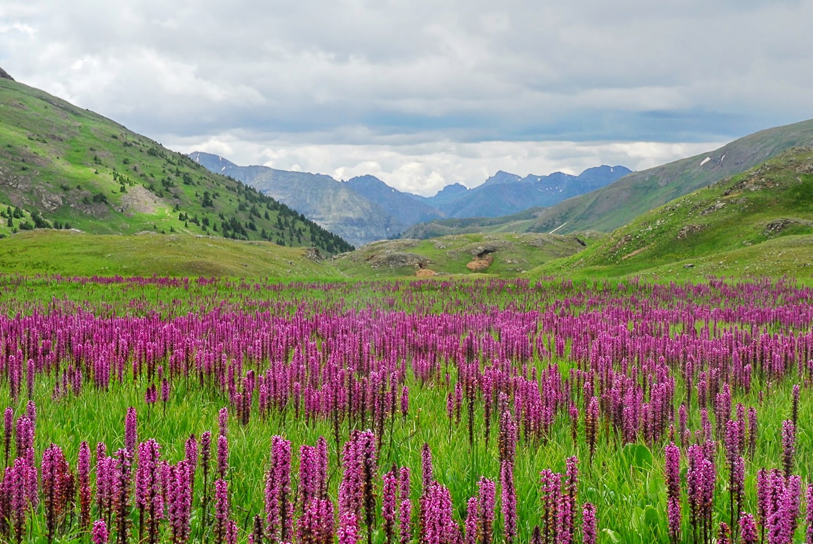
 This was a fun marshy meadow with these pretty flowers.
This was only a few miles before you reach the pass.


 12,800 ft high!


 We sure know how to pick a good lunch spot!


This is a panoramic shot from Oh! Point taken with 
Tiona's phone. Zoom in so you can get an idea
of the view you have. It still doesn't do it justice.


Sapinero Mesa

Difficulty Rating: 1. This is an easy, graded road. About half-way through it has a speed limit sign of 35 mph. 35 mph, however, seems painstakingly slow and 45-55 mph feels about right through most of it (not saying that I was speeding...).

Location: Between Blue Mesa Reservoir and Highway 149 to Lake City.

Trailhead: The north side starts on Highway 50 43.2 miles east from the junction of Highways 550 and 50 in Montrose or 21.7 miles west from the junction of Highways 50 and 135 in Gunnison. The south end starts 21.1 miles south on 149 from the junction of Highways 50 and 149 or 23.8 miles north of Lake City.

Coordinates are 38°27.89 N, 107°15.79 W at the north end near Blue Mesa Reservoir side, and 38°16.84 N,  107°10.58 W at the south end.

This is a quick, short road. It took us less than 30 minutes to drive it. The scenery isn't nearly as spectacular as the nearby San Juan Mountains, but it is still fun to get off the pavement for a nice drive. There is little vegetation through most of the drive as you can see below, which lets you see for miles and miles during most of the road.

For me, the main reason I will drive this road again is for the shortcut. If you are traveling from the Montrose area to Lake City, this will cut off about 18 miles. If you stay on pavement and drive the listed speed limit, it is 33.5 miles from the start of this road to the end. If you take the Sapinero Mesa road, it is 15.4 miles. If you drive the speed limit on pavement (65 through most of it) as well as on the dirt road (35 mph) you only save 4.5 minutes. However, it is nice to get off the pavement and cut off some miles without loosing any time. I will definitely take this shortcut again if I am traveling to/from Lake City.

Here is the GPX and KML files of our trip.


 Overlooking the Blue Mesa Reservoir

These are the Dillon Pinnacles that you
can see across the Blue Mesa Reservoir