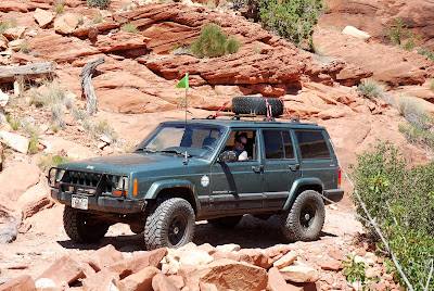
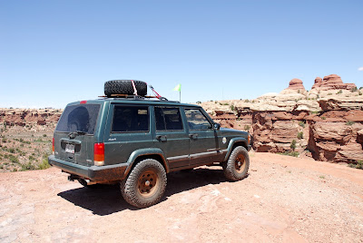
Depending on if it is torn up and the route you go, this could be done in a stock high clearance vehicle with some difficulty. Low range is necessary as there are many steps and short steep climbs. A stock Grand Cherokee (I believe it was the 1999-2004 body style) was behind us going over Elephant Hill and seemed to do well. A stock vehicle will likely take some work to get over a few of the obstacles.
Location
This is located in the Needles District of Canyonlands.
Trailhead
The road is well marked and there are signs directing you to the beginning of the trail. From the visitor center you travel 2.8 miles southwest down highway 211 to a left turn. 0.3 miles after the left turn you make a right turn. 0.2 miles after this turn you mike a right turn onto a well maintained dirt road. The GPS coordinates of the start of the dirt road are 38°09'00.5"N 109°48'02.7"W (38.150125, -109.800753). You follow this road for 2.7 miles. You come to a parking lot as many people park here and hike Elephant Hill. If you continue on the road it turns into Elephant Hill.
Description
This is a fun road that allows you to enjoy this portion of Canyonlands. The National Park Service does maintain this road, and you will notice holes have been filled with concrete to keep this acceptable to lightly modified vehicles. The beginning portion of Elephant hill is a short climb over a hill. There are many ledges, loose climbs, and tight switchbacks. One of them is tight enough that you actually travel in reverse through the length of one switchback because it is difficult to make the turn.
Once you go over Elephant Hill, there is a one-way loop that takes you through the area. There are multiple small obstacles and ledges to keep things interesting but most aren't difficult. There were a few areas I had to pick a different approach to make it up some of the obstacles.
One of the fun spots is called "The Sqeeze." This is a narrow channel through slick rock that you drive through. There is no way around. If you are in a large vehicle, take your time and make sure you have a spotter because it is easy to scrape your body on the rocks. There are many gashes left behind by the larger vehicles. We did take a Hummer through it (it was an H2), so if you are careful you can get through with a wide vehicle.
There is also an overlook to the confluence of the Green and Colorado Rivers. It is a short hike with a great view at the end.
GPS and map coming soon!
GPS and map coming soon!
This is Newspaper Rock, which is in a pull-out on the way to get to Elephant Hill.
I'm so proud of my wife!
I think it looks like my wife was having fun!
It was a TIGHT fit for the H2!
It was much easier for a TJ...
The confluence overlook is a great short hike!
We found this rock that was shaped like a chair, Molly loved it!


No comments:
Post a Comment