Thursday, September 3, 2015

Paradise Divide

Rating: 2.5. There are a few areas that can be washed out and a few steep climbs that require at least AWD in good conditions but may require 4WD. In good conditions a small crossover SUV should have no issues.

Location
Near Crested Butte, CO

Trailhead
The trail starts 0.8 miles north of Crested Butte measured from 6th St and Elk Ave (north end of the park). GPS coordinates are 38°52'47.9"N 106°58'34.2"W (38.879978, -106.976163). To road travels to the north west (left) off of 6th street.  

The loop ends and turns into Gothic Road in Mt Crested Butte. If you want to start at this end, take 6th street out of Crested Butte and follow it north and it will turn into a dirt road.

Description
This is a scenic drive across Paradise Divide and Schofield Pass. The base is good and there aren't many areas that get muddy in the rain. However, there are a few areas that can get slick and caution should be used in rainy weather. We watched a Ford Explorer struggle through a muddy area due to having street tires, but luckily he was going downhill and didn't get stuck.

If you start at the turn-off 0.6 miles, follow this road until Paradise Divide. It begins as a paved road and will later turn into a dirt road. There are multiple other roads in the area, but the main one takes you to Paradise divide. Once at the top, follow the signs to Schofield Pass and then back to Crested Butte. 

Here are the GPX and KML files.


Sawpit Cutoff

Rating: 1. This is a well maintained, gravel road that can be easily done in a passenger vehicle. 

Location: This is a cut-off between Ridgeway and Telluride, CO.

Trailhead
The north end starts 12.1 miles west of Ridgeway, CO on Highway 62, measured from the intersection of highways 62 and 550. The coordinates are 38.099930, -107.912448 (38°05'59.8"N 107°54'44.8"W). This is the same turn-off for Last Dollar Road.

The south-end begins at Sawpit, CO on highway 145. The turn-off is to the north, 4.2 miles east from the intersection of highway 62 and 145. It is east measured from the roundabout going into Telluride. Coordinates are 37°59'40.6"N 108°00'00.8"W (37.994618, -108.0002180. 

Description
This is a scenic, alternative way to travel to Telluride from Ridgeway. I doubt it saves any time, but it is shorter. It is 11.5 miles long compared to the 15.5 miles it would take on pavement.

This is a great alternative cut-off to Last Dollar Road for people who don't have high clearance or 4-wheel drive. The scenery is similar and it is a nice road to get off the beaten path a little.

Here are the GPX and KML files.


Tuesday, September 1, 2015

Sawmill Mesa

Rating: 2
This is a decent graded road, however there are a few rough areas and there can be ruts that increase the rating to a 2. Any small crossover SUV will have no issues with this road.

Location
This is just west of Delta, CO in the Uncompahgre Plateau.

Trailhead
The trail is located west of Delta. If you take 5th street to the west it will turn into Sawmill Mesa Rd Continue following this road until you see a sign that directs you to the Delta Correction Center. At this sign there is a dirt road going to the right. Sawmill Mesa Road continues to the right on the dirt road and the correction center is to the left on the pavement. GPS coordinates are 38°42'47.7"N 108°10'09.8"W (38.713245, -108.169388). There are two dirt roads going to the right at this location, the first one is Escalante Rim and the second road is Sawmill Mesa. They are about 250 ft apart and there are road signs identifying each road.

Description
This is an easy dirt road that does not require 4-wheel drive in dry conditions. Some areas could potentially be difficult in the rain as demonstrated by areas of deep ruts.

This is entry to the Uncompahgre Plateau. The scenery starts with barren scenery with little vegetation, then it develops a Juniper and scrub oak forest with occasional pinion pine, then it turns into Poderosa and Aspen forests. The Uncompahgre Plateau is used frequently during the hunting season.

This road is also great to use with Escalante Canyon or Dry Mesa Jeep Road to make a loop. Our trip today (Aug. 2015) started with Dry Mesa and we completed the loop with the Sawmill Mesa Road. For this reason, the GPS file below doesn't connect all the way to Escalante Canyon. I will update the GPS file in the future when I do the loop with Escalante Canyon.

Here are the GPX and KML files.


This was actually on the Dry Mesa Jeep Road, but it was a fun picture so I decided to include it!


Sunday, June 21, 2015

Onion Creek

Rating: 2
This is a well maintained, graded road with multiple creek crossings. These crossings are what give this a rating of 2.

Location
This is northeast of Moab on Utah Highway 128.

Trailhead
The road is located on Utah Highway 128. It is 20 miles after you turn off of US 191 from the north side of Moab. GPS coordinates are 38°43'26.6"N 109°21'20.2"W (38.724054, -109.355616).

Description
This is an easy, well maintained road. it crosses Onion Creek multiple times.  The scenery is great and makes the road worth every minute.  If you have time, you can hike up the Onion Creek narrows to more fully enjoy the scenery.

Depending on weather, the difficulty can change drastically. In June 2015 there was a flash flood. Online I found reports where people had to wait about 3 hours for the water level to go down enough so they could drive out, and it still took 11-14 hours to get out because the road was badly damaged. I have not been on the road since the flood, and I don't know how long it will be before they repair the road.

GPS, map, and pictures coming soon!

Seven Mile Rim

Rating: 4
There are multiple ledges and torn-up climbs. This would be possible in a stock Wrangler, but it will require some work to get over some of the obstacles.

Location
This is located north of Moab.

Trailhead
The trail begins north of Moab. It is on US Highway 191. If you are traveling north, it is 0.6 miles after the intersection with Utah Highway 313 and is to the left. GPS coordinates are 38°40'47.0"N 109°41'30.7"W (38.679731, -109.691869).

Description
This trail starts and ends at the same location as the Buttes and Towers trail. The Buttes and Towers trail is easier and does not go onto the Rim. If you are looking for an easier trail, I suggest Buttes and Towers.

Once you are on the trail, the route is pretty well marked with signs at all the major intersections. Some of the signs are small and just say "7M," but they are easily seen and it isn't hard to follow.

This trail takes you along the 7 Mile Rim that overlooks Highway 191. You can also see arches in the distance. It has many great views and overlooks on the rim.

Most of the trail isn't very technical, but there are many small ledges and climbs to keep things interesting. Some of the climbs are loose and rocky, some of them are slick rock ledges. The variety of obstacles make this trail fun. This is a great trail for a vehicle with a lift and open differentials--you won't likely get stuck but it is still a challenge. I thought it was perfect for my XJ with 3" lift and 31" tires.

At the end of the rim you can stop and see Uranium Arch. This is a popular lunch spot since you can eat in the shade of the arch--there isn't much shade on the rest of the trail.

There is also popular lunch spot between the Monitor and Merimac buttes. These are massive buttes that you see during most of the trail. The road goes right between them, and there is a large and flat open slick rock area that also makes a great place to stop.

Download GPS file here! This file is from the Red Rock 4-Wheeler's site rr4w.com.

Download the GPS file that includes the gravel roads here (modified from Red Rock site).


Elephant Hill

Rating: 4
Depending on if it is torn up and the route you go, this could be done in a stock high clearance vehicle with some difficulty. Low range is necessary as there are many steps and short steep climbs. A stock Grand Cherokee (I believe it was the 1999-2004 body style) was behind us going over Elephant Hill and seemed to do well. A stock vehicle will likely take some work to get over a few of the obstacles.

Location
This is located in the Needles District of Canyonlands. 

Trailhead
The road is well marked and there are signs directing you to the beginning of the trail. From the visitor center you travel 2.8 miles southwest down highway 211 to a left turn. 0.3 miles after the left turn you make a right turn. 0.2 miles after this turn you mike a right turn onto a well maintained dirt road. The GPS coordinates of the start of the dirt road are 38°09'00.5"N 109°48'02.7"W (38.150125, -109.800753). You follow this road for 2.7 miles. You come to a parking lot as many people park here and hike Elephant Hill. If you continue on the road it turns into Elephant Hill.

Description
This is a fun road that allows you to enjoy this portion of Canyonlands. The National Park Service does maintain this road, and you will notice holes have been filled with concrete to keep this acceptable to lightly modified vehicles.  The beginning portion of Elephant hill is a short climb over a hill. There are many ledges, loose climbs, and tight switchbacks. One of them is tight enough that you actually travel in reverse through the length of one switchback because it is difficult to make the turn. 

Once you go over Elephant Hill, there is a one-way loop that takes you through the area. There are multiple small obstacles and ledges to keep things interesting but most aren't difficult. There were a few areas I had to pick a different approach to make it up some of the obstacles. 

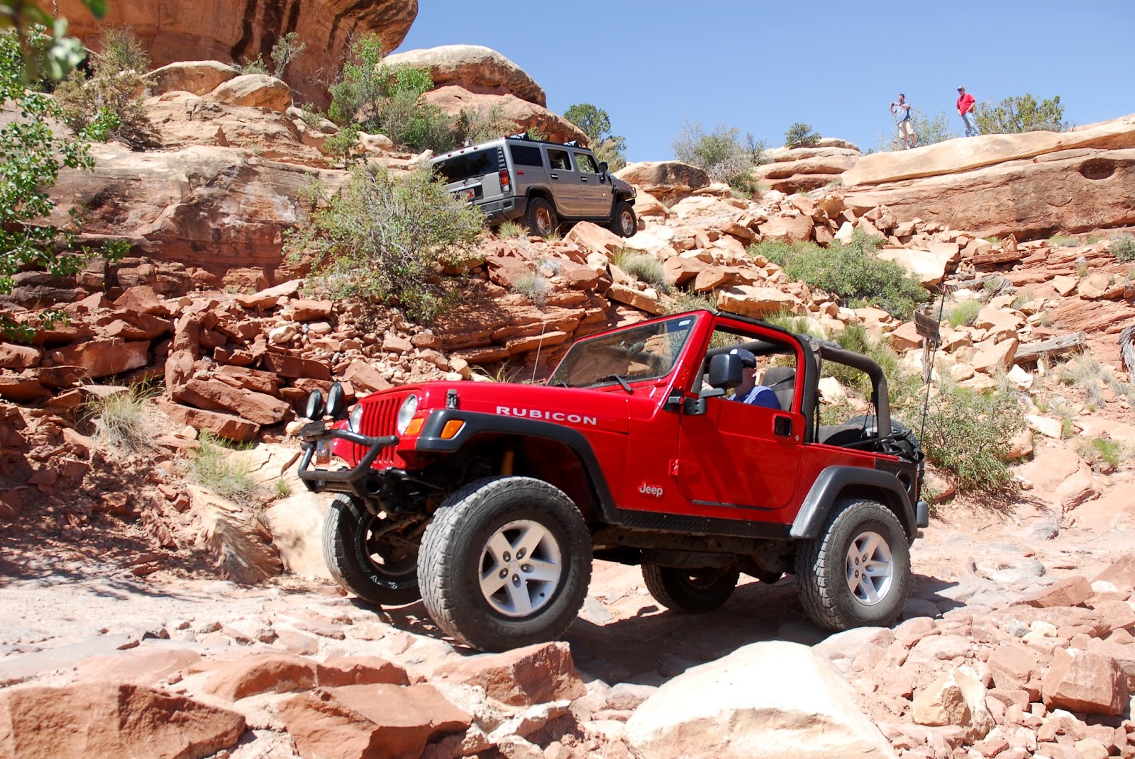
One of the fun spots is called "The Sqeeze." This is a narrow channel through slick rock that you drive through. There is no way around. If you are in a large vehicle, take your time and make sure you have a spotter because it is easy to scrape your body on the rocks. There are many gashes left behind by the larger vehicles. We did take a Hummer through it (it was an H2), so if you are careful you can get through with a wide vehicle.

There is also an overlook to the confluence of the Green and Colorado Rivers. It is a short hike with a great view at the end.

GPS and map coming soon!

 This is Newspaper Rock, which is in a pull-out on the way to get to Elephant Hill.


 I'm so proud of my wife!


 I think it looks like my wife was having fun!


 It was a TIGHT fit for the H2!


 It was much easier for a TJ...


 The confluence overlook is a great short hike!

 We found this rock that was shaped like a chair, Molly loved it!