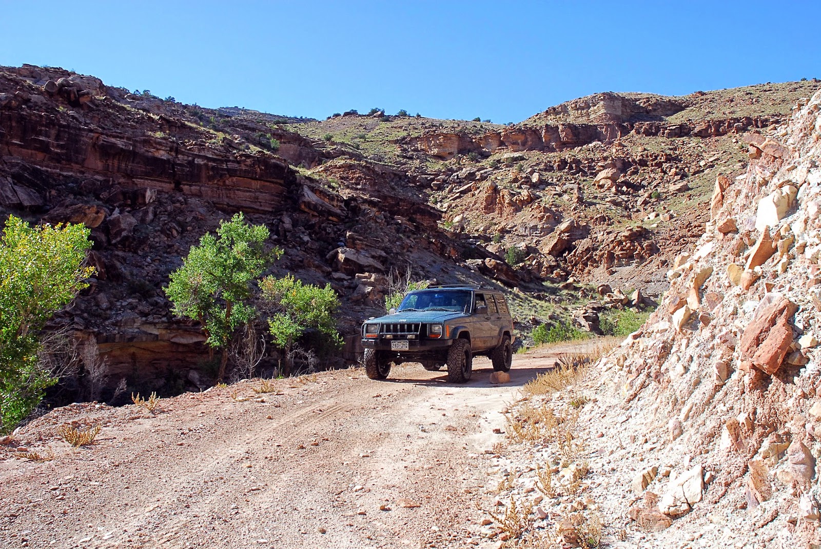
Rating: 4. This is an easy 4, but there are a few spots that would make it difficult for a lower clearance stock SUV.
Location: Just east of Delta, CO in the Gunnison Gorge National Conservation Area.
Trailhead: Starting from the more southern trailhead, it begins at Peach Valley Road east of Delta Co. We started where F road turns into Peach Valley Road. The coordinates are 38°43'35.9"N 107°56'01.1"W
(38.726627, -107.933627). Take Peach Valley Road to the east.
We ended near Austin, CO at the junction of H75 Rd and 2200 Rd. The road goes to the east from this intersection. The coordinates are 38°45'58.6"N 107°57'09.1"W (38.766283, -107.952519).
This is a fun little road in the Gunnison Gorge area. We actually did a few loops so we could be up on the rim as often as possible. There are great views of the Gunnison Gorge and a few views of Black Canyon National Park in the distance. The southern loop was the most difficult, giving this a rating of a 4. We started at Eagle Road and came down Bobcat road. Going in this direction gives you some fun climbs going up Eagle Road, many of which have 8-12 inch ledges and rocks. Some of these areas are dug out as well. I had to pick my line carefully since I have open differentials. On a few of the ledges and loose areas I spun out a few times and had to try a different line to make it up. It wasn't very technical, but some care is needed without lockers or high clearance.
Coming down Bobcat Road was also a fun road. The hardest obstacle of the day was on Bobcat Road. This obstacle would be very difficult for a stock vehicle. My Cherokee with a lift and 31" tires had plenty of clearance. This obstacle isn't too difficult, but a little higher clearance and more aggressive tires are necessary.
The rest of the trip was easier, but there were still areas that were loose and rocky. The best part was the view of the Gorge and the ride along the Gunnison River as it also had some great scenery. For me, one of the highlights is that it is near to my house!
This trail is a little more confusing as there are many roads in the area. As such, I will include some directions.
We started at F road and Peach Valley just east of Delta. We followed Peach Valley road to the east and then to the south for 9.5 miles. There is a left turn for Eagle Road. We followed this road to the rim and then followed the road north along the rim. While on the rim there is a road to the left that heads down and is called Wave Road. This road will take you back to Peach Valley Road or you can stay on the rim for a little longer and come down Bobcat Road (we did the latter).
Once back to Peach Valley Road, we backtracked and followed it north for 3.7 miles and turned right onto Ute Road. This takes you back to the rim and you follow the rim north. You generally stay to the right so you can stay up on the rim. There are a few unmarked roads that go to the right and aren't well traveled. These aren't official roads so don't follow these.
If you continue following the rim you will end up meeting the Gunnison River and will run into South River Road. Take South River Road until it ends at road H75. Turn left to get back to town.
If these don't work, here are the original GPX and KML files. There was about 20 minutes my GPS didn't record, so I had to manually repair the file. The repaired files work on my computer and GPS, but I can't guarantee they will work on other devices.
It is easy to take a wrong turn, so if you aren't able to use my GPS files there is a map of the area from the BLM website. Luckily, you can't really get lost in this area because almost all the roads connect in to the Peach Valley Road (except for the north part which connects to the South River Road).
This is the nice, easy Peach Valley Road.
This is shortly after turning off Peach Velly. Once you start going uphill it starts getting loose and rocky.
Nice view of the San Juan Mountains in the background.
Black Canyon is just over my head.
This is typical for Eagle Road and the south loop. There are a lot of ledges, rocks, and loose areas that give it a rating of 4.
This is a typical view of Gunnison Gorge.
This is taken next to the Gunnison River on the South River Road. The river is where you can see the leaves changing colors in the background.


